Mount Aspiring National Park, February 2026
Ocean Peak, off the Routeburn trail can be completed in a day from either end of the trail – for a fit scrambler at least!
We traversed over Ocean Peak from the Route Burn track Hollyford entrance, coming down to Harris saddle, before a bivvy in the Valley of Trolls on Day 1. Day 2 we did some further ‘tops exploring’ in that area before exiting back along the Route Burn track the next day. This trip report focuses on the Ocean Peak traverse from Day 1.
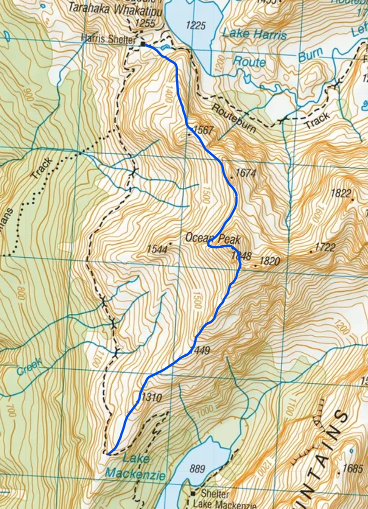
Hike from the Route Burn track start to Lake McKenzie hut is around 10kms of easy walking on the Great Walk trail. A further 2 kms from the hut brings you at an obvious ridge heading NE up to Ocean Peak (see topo below). There is a noticeable track here from prior scramblers heading onto the ridge from the Route Burn track (around 1200m).
Head up the ridge past points 1310, 1449m and up past the 1600m elevation line.
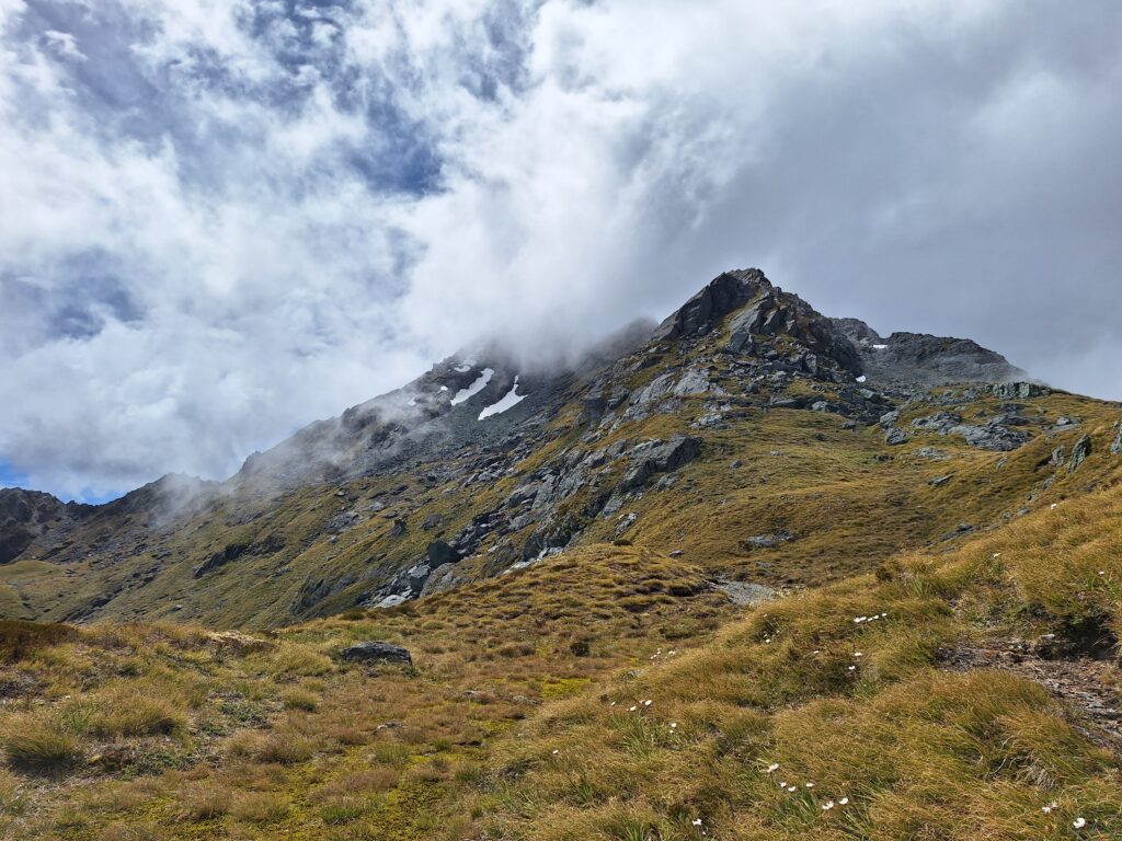
View up ridge to Ocean Peak (in cloud) – around 1449m.
From here we meandered left and right of the ridge. If you prefer more straight-forward walking, it looks like staying right of the ridge heading up was good. We hit the saddle between 1820m on the right, and Ocean Peak 1848m on the left (see pic below).
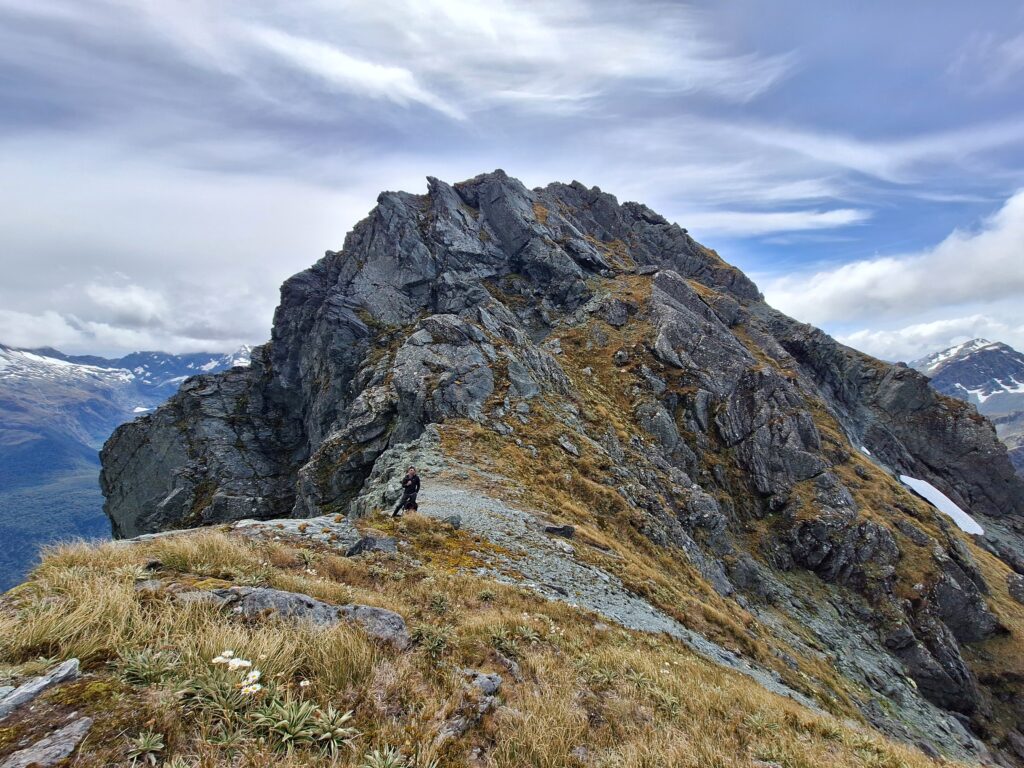
Around 1800m saddle point between Ocean Peak (shown) and 1820m.
We ascended the right-hand side of the ridge from here (see grassy ledge above, before transitioning to the rock) to reach the top of Ocean peak. The Peak has great views out to the West Coast.
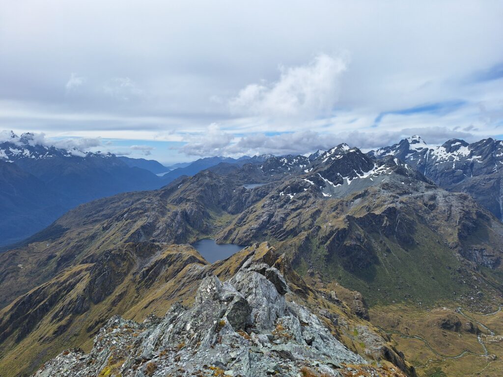
The West Coast Ocean view from Ocean Peak.
Getting down off Ocean Peak could be as easy or difficult as you want it to be. We opted for nothing too exposed and walked off the Peak on the west, probably dropping to around 1600-1650m before traversing under bluffs to the obvious saddle between Ocean Peak and 1674m.
There is probably a way to stay on the ridge the whole way down to Harris Saddle. We opted to sidle West of point 1674m before coming to the saddle before 1567m. There was a bit of a ravine at this saddle to navigate through, before climbing back up to 1567m and down.
We did a straight line from around 1400m to Harris saddle – in hindsight it may have been easier/possible to continue on the ridge and intersect the Route Burn track before turning left and back along to Harris saddle. There was a steep section to get through the line we chose, from around 1300m to Harris saddle.
For anyone that wanted to make this a (big) day trip, it is easy enough to hike out from here back to the road end (roughly 16kms from Harris saddle). Total distance if doing as day trip would be around 32kms-ish, with around 1350m gain (excluding undulations).
See our route on the topo below for the off-track traverse over Ocean Peak.
Leave a Reply