Remarkables Conservation Area, April 2026
A great traverse up the front of the Remarkables, and around Queens Drive to the upper Remarkables ski field car park. Typically 5-7 hours depending on fitness and route finding – this trip took us 5.5 hrs.
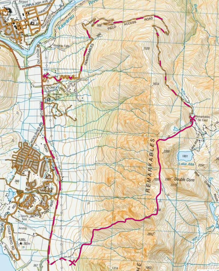
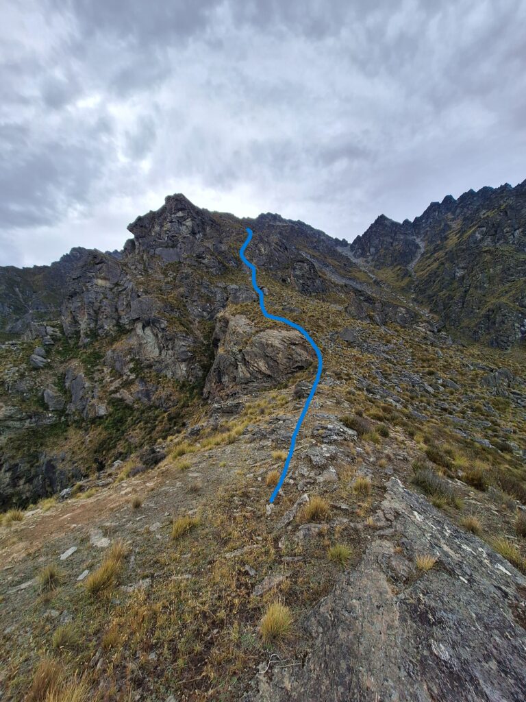
Topo of our traverse from Jardines Boulders (x at bottom), up Te Tapuae ridge, along Queens Drive and down the ski field to the car park.
We parked at Jardines Boulders to start the day. The boulders are open to the public via access from a Deer gate on the main road (sign posted) – be sure to check with the Queenstown Climbing Club for current information on access (i.e. can be closed due to lambing season / fire risk).
From here we followed the fence line along to a small ridge between the two streams around 600m elevation and made our way through a (rough) track to cross the northern stream. I’m sure there are a few ways through here but if you find the track, it avoids a little bush bashing through this creek.
Once on the other side, it is relatively open bush / grass / rock to gain the ridge around 850m. There are some cairns up to this ridge – lots of ways go – but maybe these are most helpful if you were coming in reverse and wanted to find the track through the creek.
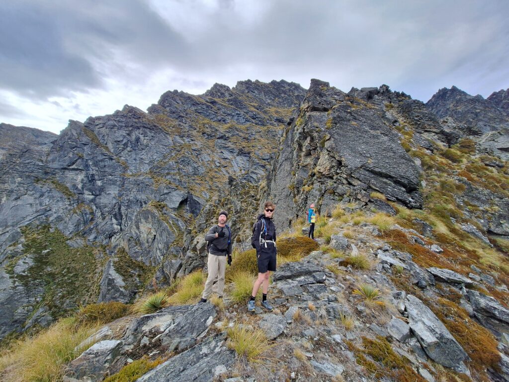
Once on the ridge, you are typically on the ridge or southern side of it (never north side), all the way to point 2036m.
A few images below show the route we took and type of terrain covered. In short – amazing views, a mix of rocky ridge travel, steep tussock / bush sections, a little steep scree sidling (to be respected), and a couple of smaller rock-moves right at the top. I opt to wear a helmet on this, many don’t. On this trip I followed at the top and so it was useful to have a helmet in case of the odd rock fall triggered accidentally by trip-mates above.
In the winter/snow or the wet, the steeper tussock/bush sections could feel more intense I expect.
It took us 3.5 hrs from our car at Jardines Boulders to point 2036m.
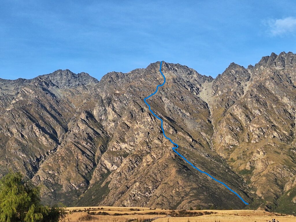
An estimate of our line up
Views west (around 850m or 950m)
Views up (around 950m)
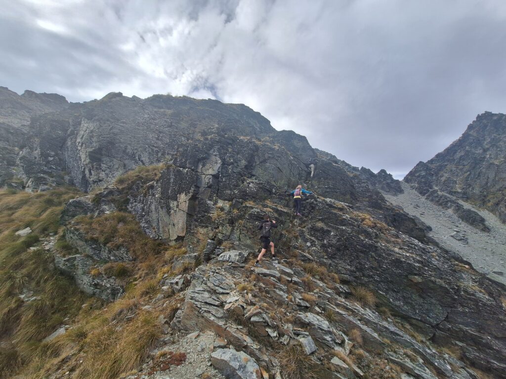
Some fun scrambling up
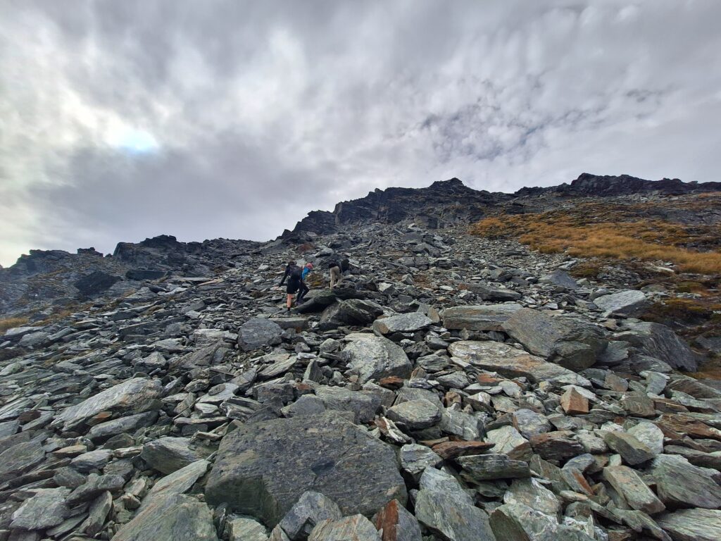
View from around 1050m up, as it gets a little steeper. Our line hugging a bluff on our right, up a tussock shoot.
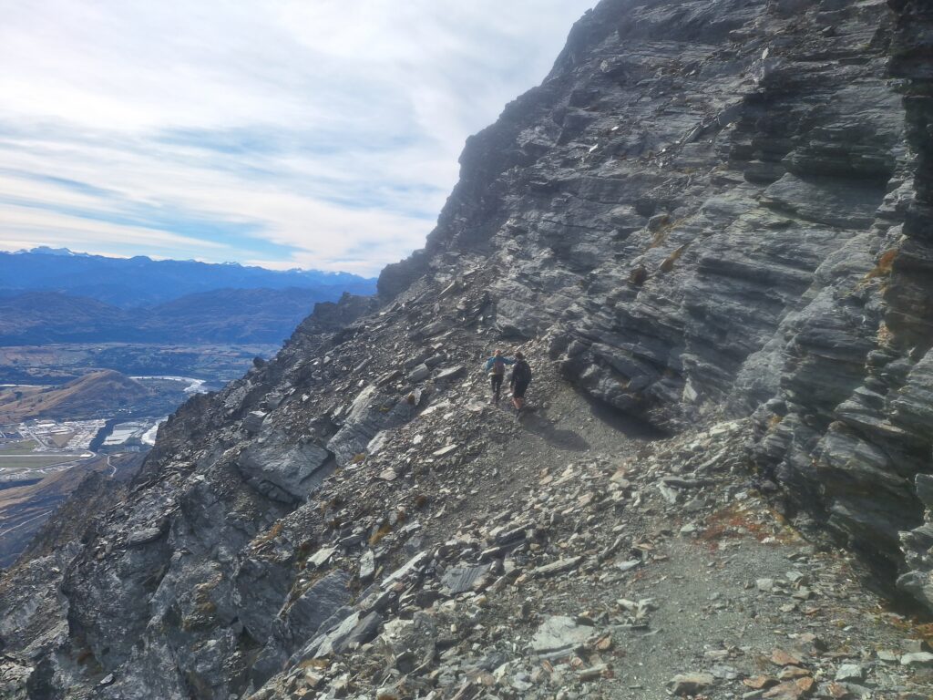
Pick your way through some of the steeper sidling sections – a few ways go

Nice views SE as we get closer to the top
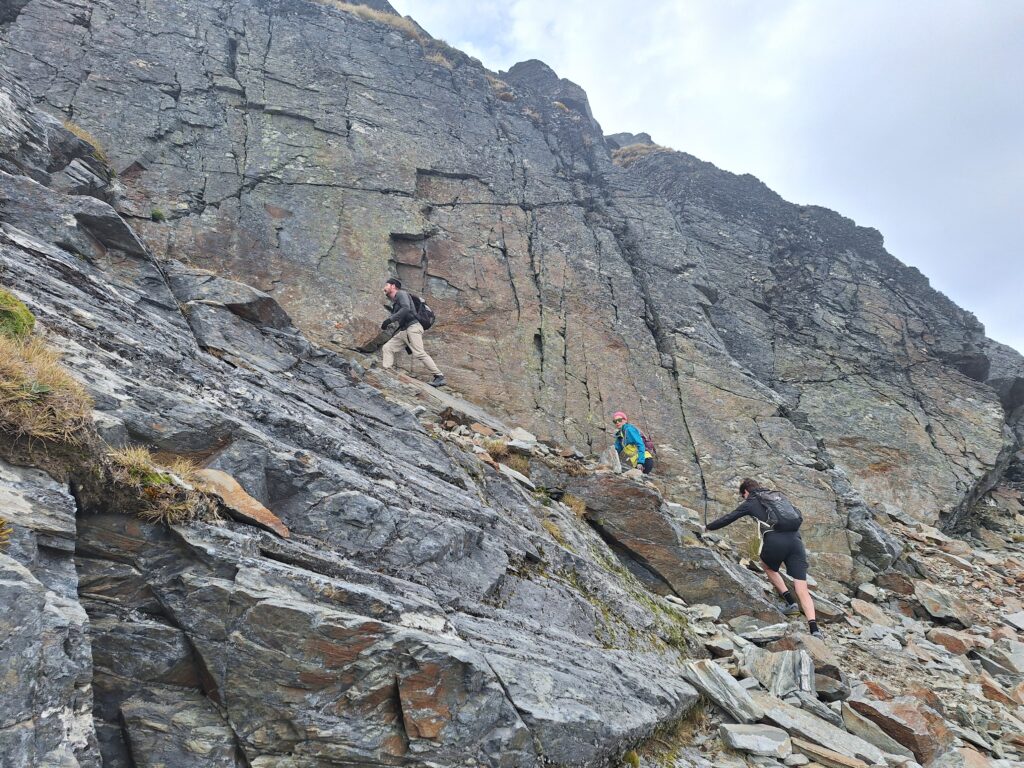
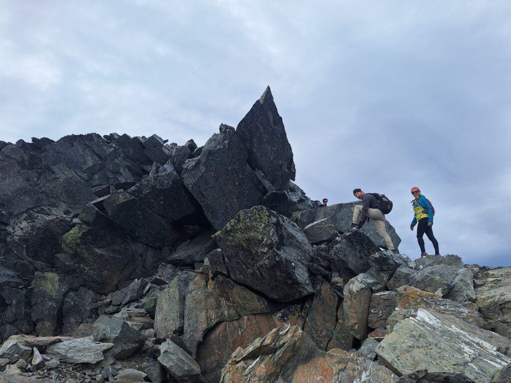
Picking our way through some slabs – really pleasant rock
The plod up the rock field before the top
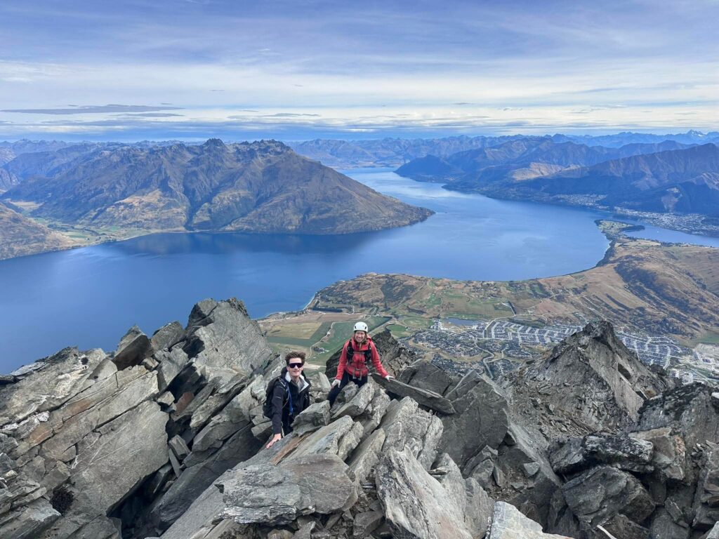
So close!
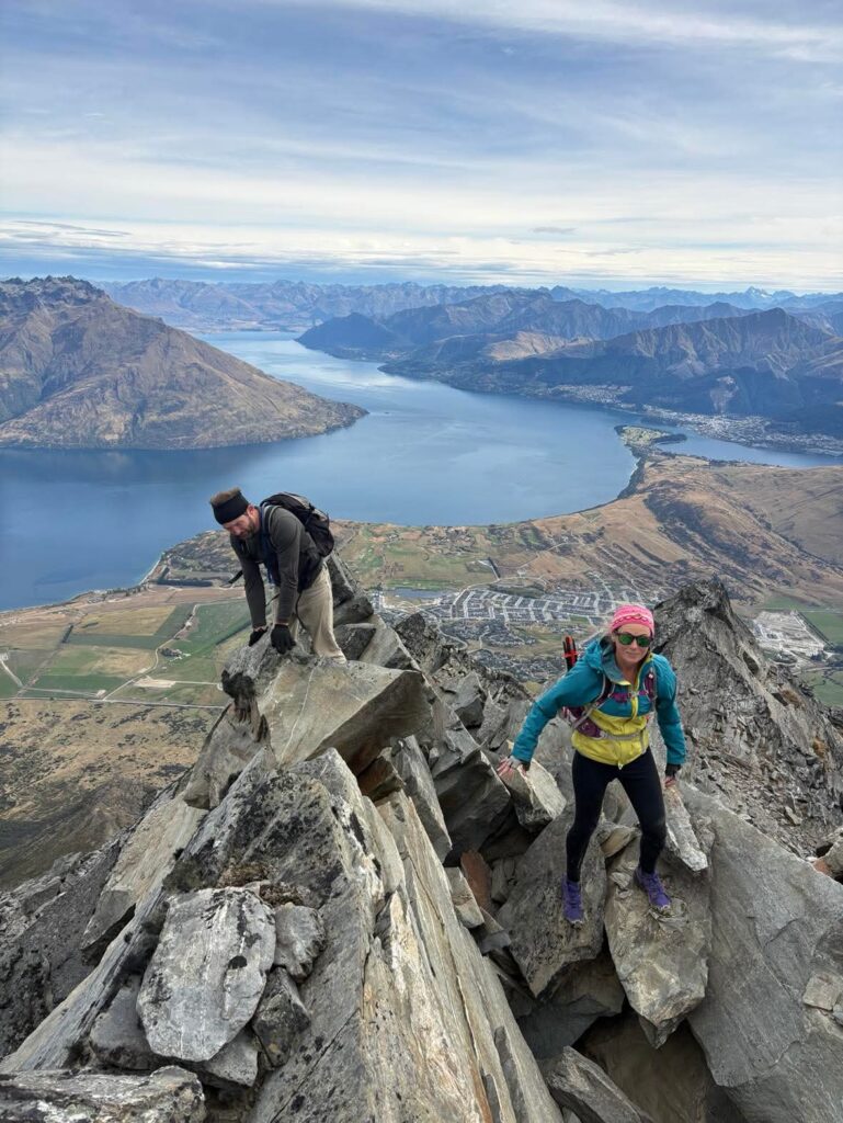
One little move to gain the top from the south side (avoidable if you prefer)
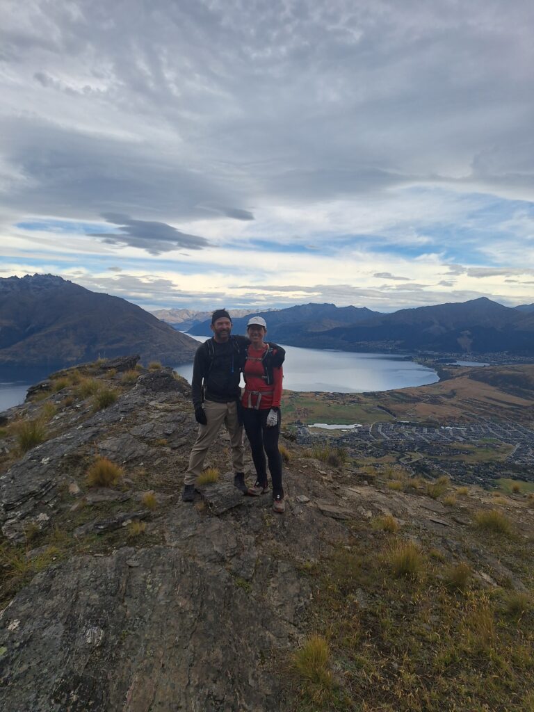
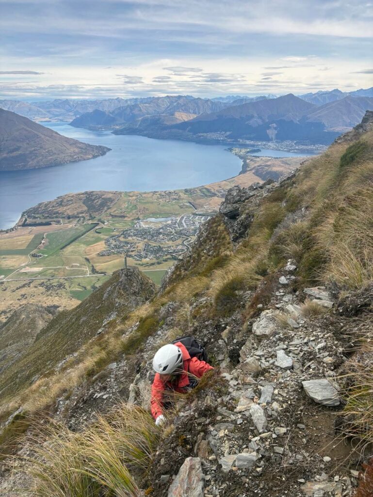
Summit of point 2036m and views west
After a little bite of lunch, we traversed to Queens Drive (around 1950m), walking below Double Cone and point 2200m. Queens Drive I think it is good to have a bit of respect for and watch your footing on a few of the angled gravel sections with not much to support you. Sometimes poles along here are helpful for balance / extra support in these sections.
Once around to the ski field area, it is an easy walk through the ski field to the upper Remarkables car pack. It took us 2 hours from point 2036m to the ski field. All up, 5.5 hours from our car at the bottom.
Getting down you can either hitch hike (usually works out!), or on this occasion one of our party had driven up in the morning to leave a car there and biked down. After a little car collection logistics at the end, it was time to enjoy an autumn beverage looking up at our hike of the day. 10/10 traverse.
Leave a Reply